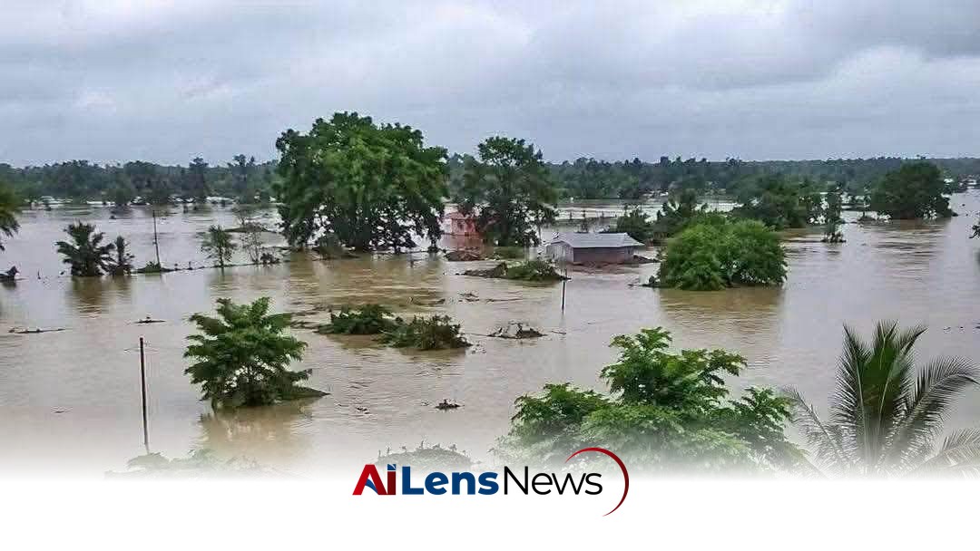


A hydrological assessment reveals that the recent flash floods in Upper Assam were primarily caused by extreme rainfall in upstream hill catchments, not local rainfall.
Kohima, India Jul 23, 2026 ALN: Guwahati: An official hydrological assessment has concluded that the devastating flash floods that inundated Upper Assam last week were triggered primarily by extreme rainfall over the hill catchments, lending scientific backing to the Assam government’s claim that the disaster originated upstream rather than from local rainfall alone.
The report, prepared after analysing rainfall between July 18 and 20, indicates that the region received 85 mm of rain against a normal of 30.3 mm — an excess of 181%. The significance of this data cannot be overstated, as it highlights the increasing unpredictability and severity of weather patterns in the region, which has been a growing concern for both local authorities and residents alike.
The deluge generated massive runoff into river systems flowing into Assam, inundating Sivasagar, Jorhat, and Charaideo, and causing widespread damage to homes, agriculture, roads, and other infrastructure. The impact of such flooding is often felt long after the waters recede; the destruction of crops can lead to food shortages, while damage to infrastructure can disrupt local economies and hinder recovery efforts.
Among the worst-hit districts, Mokokchung recorded 238.9 mm of rainfall — 493% above normal — followed by Zunheboto with 181.7 mm (419% above normal) and Kiphire with 99.6 mm (427% above normal). Such extreme deviations from average rainfall figures indicate not only the immediate threat of flooding but also raise concerns about the long-term viability of agricultural practices in these regions, which are heavily reliant on predictable weather patterns.
The report notes that the same weather system triggered multiple landslides and flash floods across the region, particularly in Mon district, underscoring the severity of the event. Landslides can lead to blocked roads and further complicate rescue and relief efforts, as well as pose ongoing risks to communities living in vulnerable areas.
Upper Assam, too, witnessed exceptionally heavy rainfall during the period. Charaideo received 170 mm (436% above normal), Golaghat 147.9 mm (325% above normal), Jorhat 105.2 mm (143% above normal), and Sivasagar 93.2 mm (134% above normal). These figures illustrate a broader trend of increasing rainfall and extreme weather events in the region, which has been linked to climate change and its impact on monsoon patterns.
However, the report concludes that local rainfall alone cannot explain the scale of the flooding. Instead, it attributes the disaster to an extreme hydrometeorological event over the upper catchments, where heavy rain over steep hills generated rapid runoff that surged downstream into Assam, pushing rivers beyond their carrying capacity and inundating areas not usually prone to flash floods. This phenomenon highlights the interconnectedness of weather systems across geographical boundaries and the need for comprehensive regional planning and response strategies.
The findings broadly echo Assam Chief Minister Himanta Biswa Sarma’s assertion that the catastrophe warrants a deeper scientific investigation. The Chief Minister’s proactive approach in acknowledging the complexity of the situation is crucial for developing effective disaster management strategies in the future.
Referring to reports of a cloudburst in the region, Sarma said the government would examine satellite imagery to determine exactly what transpired in the upper catchments and whether similar events could recur. The use of satellite technology in disaster assessment can provide invaluable insights into the scale and impact of such natural events, enabling authorities to make informed decisions regarding emergency responses and infrastructure development.
“They have said a cloudburst occurred, but what else happened along with it we will have to examine through satellite imagery. We also need to find out whether it was a one-time occurrence or something that could recur,” the Chief Minister said. This statement reflects a growing recognition of the need for data-driven approaches in disaster management, moving beyond reactive measures to proactive planning.
He said the government would undertake a comprehensive study after the floodwaters recede, with particular focus on satellite imagery of Mon district. This approach underscores the importance of integrating technology and scientific research into disaster preparedness and response strategies.
“After the floods recede, we will thoroughly study satellite maps to figure out what went wrong on the fateful day of the cloudburst in the region and devise our strategies accordingly,” Sarma said in a post on X. This commitment to thorough investigation and analysis is essential for ensuring that future responses are more effective and tailored to the specific challenges posed by such extreme weather events.
The proposed study is expected to help Assam develop long-term flood mitigation and disaster preparedness measures for downstream districts that remain vulnerable to sudden surges in rivers originating in the upper catchments during extreme weather events. This is particularly important in a region where communities are often at the mercy of unpredictable weather patterns, and where infrastructure and emergency services may not always be adequately equipped to handle such crises.
In addition to immediate relief efforts, the findings of this assessment could inform broader discussions about climate resilience and sustainable development in Assam and the surrounding regions. As climate change continues to exacerbate the frequency and intensity of extreme weather events, it is imperative that local governments, communities, and stakeholders collaborate to develop comprehensive strategies that address both the immediate impacts of flooding and the underlying vulnerabilities that contribute to disaster risk.
Ultimately, the experience of Upper Assam serves as a critical reminder of the importance of preparedness and adaptability in the face of an uncertain climate future. By leveraging scientific research, community engagement, and innovative technologies, it may be possible to not only mitigate the impacts of future floods but also to build more resilient communities that can withstand the challenges posed by a changing environment.
To learn more about the latest developments in Natural Disasters, stay updated with our exclusive reports and analyses on AiLensNews.